Blue Crystal Mine

IMG_20140704_195420
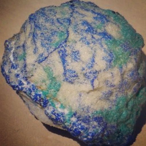
There are two places out in the La Sal mountain area South of Moab where you will find bubbles of earth containing azurite, malachite, and chrysocolla.  One of them is the Blue Crystal Mine, owned by Bill and Ekaterina Harrison (website: http://bluecrystalmines.com/Blue_Crystal_Mines/Home).

[Edit] ***The only way you will be able to collect at this location is through the folks at the Rockpick Legend rock shop in Salt Lake City. They will organize field trips to this location. Aside from these trips, this is a private mine that is not open to the public. Please do not just show up at this location expecting to collect and please do not call the mine owners. If you collect without permission you will be ticketed.***

I had the opportunity to go on one of the field trips led by Rick from Rockpick Legend. There were about 15-20 people in total and we had the whole of all of the mine tailings to ourselves!

IMG_20140704_195828
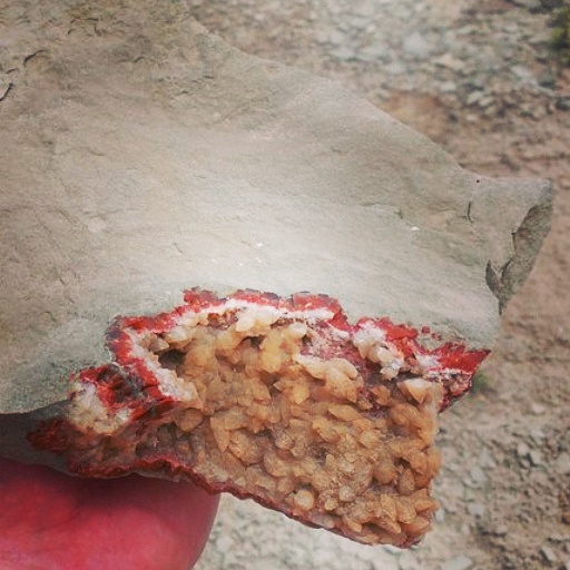
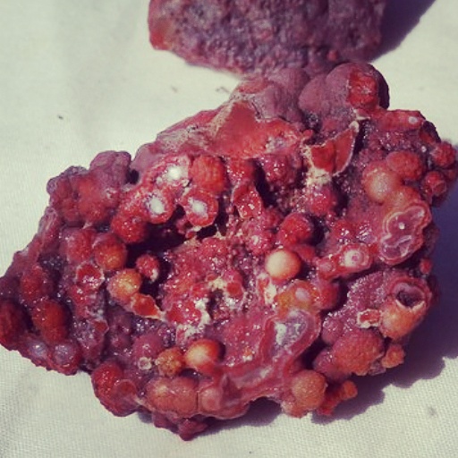
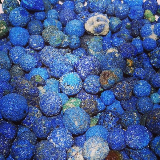
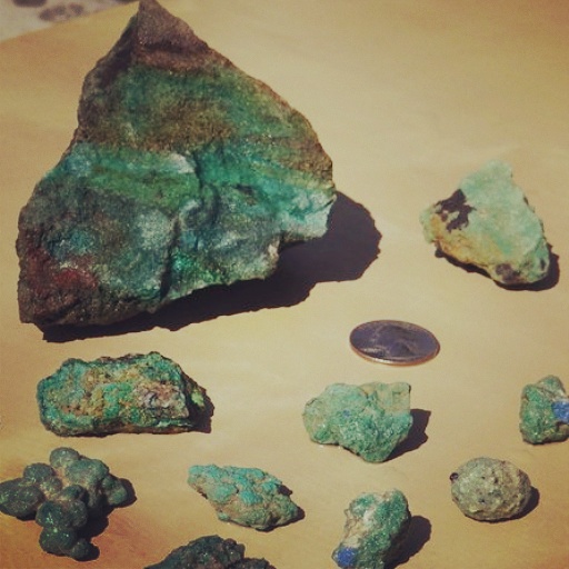
Mostly, what you will find there are what they call “blueberries”–little concretions of azurite (You can find the same concretions of malachite balls, but I guess people like the bright blue better than the green ha ha ha). The value increases the larger they are because of the rarity of the larger specimens.

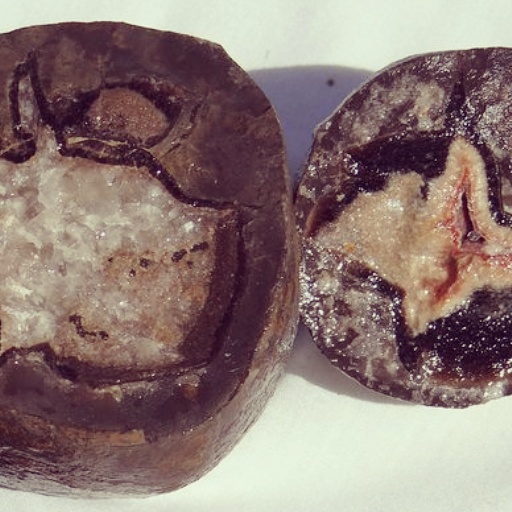
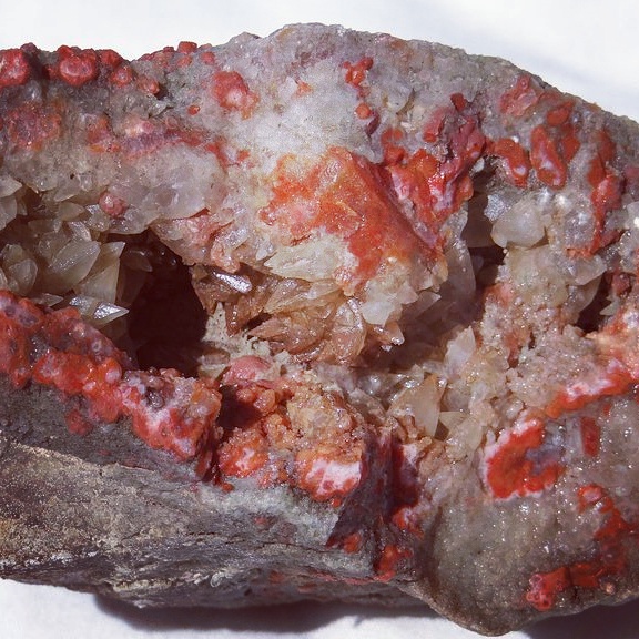
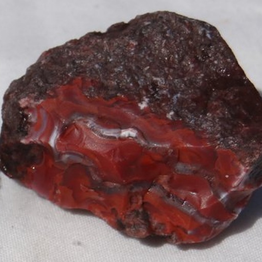
Sometimes you can find gemmy azurite or even azurite geodes. If you cut any of these open (including the blueberries) you will find that the blue gets darker, sparklier, and prettier toward the center. Bill has a small shop on site where you can purchase specimens up to $1000.

Directions to Blue Crystal Mine:

From the intersection of 800 North and I-15 in Orem, Utah

IMG_20140704_200517 1. Drive South on I-15 for 13.5 miles to Spanish Fork exit 258. Stay left onto Highway 6

2. Drive Southeast on Highway 6 for 127 miles until you hit I-70

3. Turn left (East) on I-70 for 23.7 miles to exit 182 and turn right onto Southbound Highway 191

4. Drive for 53.7 miles on Highway 191 through Moab and turn left (East) on UT-46

5. Drive 6.5 miles on UT-46 until you hit Lisbon Road/Highway 113 and turn right (South)

6. Continue 5 miles on Lisbon Road/Highway 113 until you reach your destination (the road cuts right through the middle of the mine)

Summit

My Dad and I had signed up to go hunting down near St. George for some agate with a group of other fellow rock hounds. Unfortunately, when we got there early on Saturday morning, they had cancelled due to recent heavy rains. The areas they had planned on going were in nearby canyons and the chance of flooding or getting stuck was just too high to be worth it.

Since we didn’t want to drive all the way down there for nothing, we figured we’d hit up some of the safer areas in the reference books we had read or other areas we had heard about. The most productive area we visited ended up being just South of the small town of Summit (in between Cedar City and Parowan).

We drove up the road a little ways and, upon getting out of the car, I saw instantly that we were in the right place. Lots and lots of blues, reds, oranges, yellows, whites, and blacks. Such vibrant colors! I knew this area was famous for the sky blue agate many people use for making cabochons or other jewelry and so the hunt was on.

When you get to this area (which is being developed more and more for housing each year), it is tempting to look in the flat areas near the road and in the washes, but we actually had the most success trekking up into the steeper foothills to where the source was.

Walking along the road, I also found a small bullet that had already been fired. The side of it was all melted and scratched like it had grazed off of a tree or rock or something. The odds of finding something like that out in the wild just seem crazy.

It is always great to have a rock hounding buddy and I was fortunate that my dad was able to come along on this day. I think he is already addicted after just one trip ha ha ha! The general area around Cedar City, Parowan, and Brian Head ski resort is known for having a great variety of high quality agate and I am stoked to return to some of the other nearby areas.

Directions to Summit:

From the intersection of 800 North and I-15 in Orem, Utah

1. Drive South on I-15 for 201 miles until exit 71 for Summit, Utah

2. Upon exiting, turn left (East) toward the town

3. After going under the freeway, turn right on the first street you come to called Summer Tree Drive

4. Drive 1.85 miles until you hit a street that goes left (East) up into the mountains and turn there

5. After about .4 miles or so there is a fork in the road. You can hang a right and stop whenever/wherever you’d like. Look to the South all over these foothills

East of Clawson

IMG_20140704_201231I went along with my brother and a friend from work down to an area just East of Clawson, Utah (Southwest of Castle Dale). The specimens of interest were septarian nodules and various fossils. We brought plenty of buckets and water and a surety that we would bring back loads of good stuff.

I had heard that one had to dig like a madman to get the good whole septarian nodules and when we saw the ground littered with pieces we started shoveling furiously to see what was in store. Some of the nodule pieces were amazing and I could only imagine how stellar the whole ones would look once we cut them open.

IMG_20140704_193523There was a ditch on the left hand side of the road (it looked human-made; maybe an excavator?) and when we started digging on both sides of the ditch we started seeing the septarians emerge like little dinosaur eggs being uncovered from the black soft shale. They ranged anywhere from 2-3 inches in diameter all the way up to basketball size.

Terror struck again as I was digging and came face to face with a yellow scorpion whilst uncovering yet another small nodule. It looked no bigger than a baby (scorpion that is ha ha), but it sure got my heart racing. We took some pics and let the little guy go far away from the dig site.

IMG_20140704_200726Moving a little further down the road, we came upon rolling hills filled with all manner of fossils. By this point we ended up spending most of the time exploring since it was too hot to just sit in one place. I did manage to find a sizable fossil that we all thought was pretty neat.

On the way home, we hit up a small rock shop in Castle Dale and enjoyed the long drive back to civilization. Good times were had by all and we are highly likely to visit these sites again.

Directions to East of Clawson:

From the intersection of 800 North and I-15 in Orem, Utah

1. Drive South on I-15 for 13.5 miles to Spanish Fork exit 258. Stay left onto Highway 6

2. Drive Southeast on Highway 6 for 67.7 miles to exit 241 and turn right (South) onto East Carbon Avenue/UT-10

3. Continue 37.1 miles and take a left (South) onto North Main Street in Clawson, Utah

4. Drive .4 miles and turn left (East) onto Center Street

5. Continue 4.1 miles until destination on left

Hatt Ranch, Greasewood Draw, and the Squeeze

IMG_20140704_201910Although this wasn’t my first trip, it was the most recent, so we are starting off our journey here. My good friend Jared and I recently headed down near Green River, Utah to some sites along the San Rafael Swell.

We had heard you can find these geode filled mud balls anywhere from just North of Goblin Valley all the way up to I70 along the swell. And, of course, to pick up any petrified wood, agate, or anything else would just be an added bonus!

After walking around for quite some time, we had come up mostly empty handed. Some fossilized coral, a moqui ball, and an old rusty flask (but no drunken prospector!) was all we had to show for ourselves. Not to mention I had a total of three heart attacks–

IMG_20140704_2017501. Walked right up on huge snake just chilling in the sun (I couldn’t even begin to tell you what kind it was as I was a little preoccupied with not pooping in my pants).

2. Observed two spiders that had apparently either fought or mated to the death (their two giant black bodies were intertwined and long since expired).

3. Had a jack rabbit who waited until I was about two feet away before freaking out and jumping around making quite a show (I was already on edge with my knife at the ready waiting for another snake or the ghost of the prospector).

IMG_20140704_202038After driving along a few more miles, Jared (or Big J as we like to call him) about jumped out of the car before I had the chance to stop. He had seen a flash of red alongside the road and demanded we stop right then and there.

Much to our delight, we (And by we I mean Big J) found the cash crop. A scattered shale outcropping was intermingled with numerous pieces of jasper, agate, calcite, and celestite. Cuts and scattered pieces of geodes contained super brilliant colors. We filled up a few buckets and dug around for another hour or so in an attempt to gather some whole geodes to cut back at home. It was an agate-filled mudball geode wonderland!

IMG_20140704_202255For any interested, we jotted down the GPS coordinates for this particular site (don’t worry…although you could tell that others had been there before, we have only scratched the surface).

Here they are: 38°51.5′N and 110°25.6′W

Directions to Hatt Ranch, Greasewood Draw, and the Squeeze:

From the intersection of 800 North and I-15 in Orem, Utah

1. Drive South on I-15 for 13.5 miles to Spanish Fork exit 258. Stay left onto Highway 6

2. Drive Southeast on Highway 6 for 127 miles until you hit I-70

3. Go left (West) on I-70 for 8.3 miles to exit 149 and take a left on UT-24

4. Drive 3.8 miles to a turn off to the right toward Hatt’s ranch and take this road due West

5. Go straight West for another 4.1 miles to an intersection

6. Take a left at the intersection and drive for 600 feet to the destination

7. On this one I had to use Google Earth so I hope this is the correct outcropping. If not, feel free to explore around the area because you will find great stuff all around you